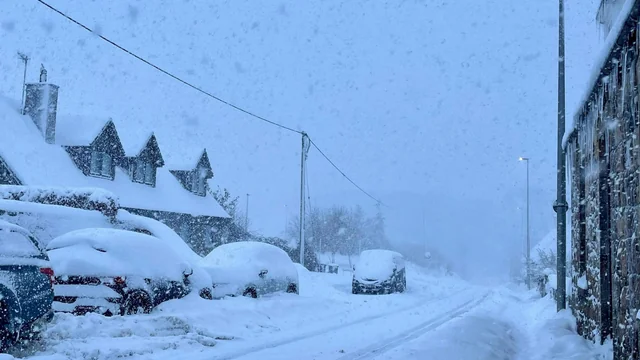
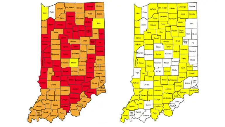

You open the map. Your county is yellow. The office sits two counties away, one of them orange, and the usual road between them crosses a low area that floods. So, is the trip fine?
That question shows both the value and the limit of the Indiana travel advisory map. It gives a quick county picture. It does not check the street by your home. It does not promise that an interstate is open. It cannot decide if your work trip can wait.
The map works best as a first check. Then read the colour and update time for every county on the route. Add the latest road and weather reports before you decide.
The Three County Levels, in Plain English
Indiana counties use Advisory, Watch and Warning levels. The colour is a shortcut; the written status is the important part.
Always open the county detail if it is available. A single map view may not show the local restriction or reason behind the change.
| Colour | County level | General meaning |
|---|---|---|
| Yellow | Advisory | Routine travel or activities may be limited in some areas |
| Orange | Watch | Conditions threaten public safety; make only trips that cannot wait |
| Red | Warning | Highest local level; travel may be restricted to emergency needs |
Yellow does not mean “nothing to worry about.” It means conditions deserve attention. Orange is a stronger signal to limit the journey. Red is not a creative-route challenge; follow the county’s official instructions.
The county authority decides the local status. That is why neighbouring counties can show different colours during the same storm. Snow bands, flooding, road treatment and local conditions do not stop neatly at a state-wide average.
How to Read the Map in Five Minutes
Start with the county where you are standing. Then trace the entire journey, including the destination. If the route clips the corner of another county, check that one too.
Next, look at update times. A yellow status from early morning and an orange status posted ten minutes ago do not carry the same freshness. When the timestamp is old during fast-changing weather, check the county emergency-management or sheriff information directly.
Now add two more layers: Indiana road conditions and the National Weather Service forecast or warning. The county colour, a road closure and a forecast answer different questions. You need all three.
Finally, check the return. A midday trip may be easy and the evening drive icy. The map at departure is not a promise about six hours later.
What the Colour Means for a Real Plan
The same status affects different journeys in different ways. A short trip to collect medicine is not the same decision as an optional dinner across four counties.
Use the map to frame the question, then contact the organisation involved when the answer changes work, school or medical care.
| Situation | What to check | Practical next move |
|---|---|---|
| Daily commute | Every county, timestamp and employer policy | Ask before leaving, especially at orange or red |
| Medical appointment | Route, clinic notice and urgency | Call the provider rather than guessing |
| School activity | School messages and bus-route conditions | Follow the district’s direct update |
| Airport trip | Counties, interstate incidents and flight status | Leave margin or consider an airport hotel |
| Field or delivery work | Local limits and employer procedure | Ask the employer whether the trip can wait |
| Family visit | Outward and return forecasts | Delay if optional and conditions are worsening |
An employer, school or event organiser may cancel even when a county remains yellow. A service that people rely on may still operate under orange conditions with its own safety rules. The map is public information, not a replacement for that direct message.
Yellow Advisory: Slow Down Before Conditions Force You To
Yellow is the lowest of the three county levels, but it still tells you that routine travel or activities may be affected. Expect untreated side roads, standing water, drifting snow or other local problems depending on the event.
Allow more time. Use a main-road route. Bring fuel or charge, a phone cable and warm clothing. If the trip can wait and the forecast is getting worse, yellow is a good reason to stay home. Do not “wait for orange.”
Do not assume the whole county looks like the road outside your house. Northern and southern parts of a large county can experience different conditions.
Orange Watch: Ask Whether the Trip Is Truly Needed
At orange, conditions threaten public safety and only trips that cannot wait are advised. That is a clear step up.
Call the workplace, school, clinic or service before leaving. Ask what it expects employees or visitors to do. “The map is orange” is useful information; “I assumed I had to come” is not a travel plan.
If the journey is necessary, use major roads, share the route and arrival time, and avoid shortcuts through untreated areas. Pack for a delay. A normal 40-minute drive may not be normal today.
Red Warning: Read the County Instruction
Red is Indiana’s highest county travel status. Travel may be restricted to emergency management workers and people necessary for public safety, depending on the local declaration.
Do not treat an open-looking road or a navigation app as permission to go. Read the official county notice. If you believe the trip cannot wait, confirm it with the employer or local authority.
A red county can still contain moving traffic: emergency crews, road teams and other authorised or necessary travel. Their presence does not mean ordinary travel is encouraged.
The Map Is Not a Live Road Camera
A county can be yellow while one bridge is closed. It can be orange while an interstate remains passable. The map reports a county travel level, not the condition of every mile.
For the actual route, use the state traffic source for closures, crashes and road conditions. Check local authorities for county roads. Navigation apps help with routing but may not understand a legal or official travel restriction.
The same caution applies to flooding. A map colour cannot tell you the depth of water on a particular road. Never drive around a barricade or into water when the depth and road surface cannot be seen.
Build a Multi-County Route Before Leaving
Write down the counties in order. It sounds overly careful until a map is hard to read on a small phone in poor signal.
The approximate distances below show how quickly an Indianapolis journey becomes a multi-county decision. They are planning figures; the route and road conditions decide the real time.
| Destination from Indianapolis | Approx. road distance | Why the county check matters |
|---|---|---|
| Bloomington | 51 miles / 82 km | The route leaves the Indianapolis area quickly |
| Lafayette | 63 miles / 101 km | Conditions may change north of the city |
| Fort Wayne | 126 miles / 203 km | Several counties and a long return window |
| South Bend | 150 miles / 241 km | Lake-effect weather may differ greatly |
| Gary | 151 miles / 243 km | Multiple northern counties and urban traffic |
| Evansville | 166 miles / 267 km | A long north–south weather change is possible |
Do not focus only on the destination. The most difficult county may be in the middle. And if an alternative route adds three unfamiliar rural roads, it may be worse than waiting for the main road to reopen.
Winter Car Checklist
For snow or ice, clear the entire car, not one windscreen patch. Check tyres, lights, wipers, winter screenwash, fuel and phone charge.
Carry warm clothing, water, a snack, an ice scraper, a flashlight and medicine you must take. A blanket is small until you need one. Share the route with someone who will notice if you are late.
| Check before moving | Good sign | Reason to wait |
|---|---|---|
| Tyres | Proper pressure and useful tread | Low pressure, damage or poor tread |
| Windows and lights | Fully clear and working | Ice, snow or a failed lamp blocks the view |
| Fuel or charge | Enough for delays and a detour | Only enough for the normal drive |
| Phone | Charged with cable or power bank | Low battery and no backup |
| Route | Main roads open in every county | Closure, flooding or a red county status |
| Return time | Conditions stay steady | Freezing rain or falling temperature later |
Drive gently and leave a far larger gap. Four-wheel drive can help a vehicle move; it does not give it a special exemption from ice.
If visibility or grip becomes worse than expected, turn back or stop in a safe place. Continuing because “we are halfway” is not automatically the safer choice.
Floods and Severe Storms
The Indiana system is not only about snow. Counties may change travel levels for flooding, tornado damage, dangerous winds or other emergencies.
During flooding, the hazard can be invisible. Water may hide a washed-out road. During strong winds, debris and power lines may block a route after the map was updated.
Read the cause of the advisory. A winter kit does not solve a flash-flood road, and an all-wheel-drive vehicle does not make moving water safe.
Phone Access and Screenshots
Save the official map page and road-condition page before leaving. A screenshot can preserve the county names, but it freezes the status at that moment. Never treat an old image as live information.
If coverage drops, radio weather and road reports can help. Tell someone the planned route and expected arrival. Keep the phone charged rather than running unnecessary video or navigation screens at full brightness.
Recheck during a safe stop. Not while driving.
Frequently Asked Questions
Local county authorities set and update the travel level. Check the county’s official notice for detail.
No. It is the highest travel status and may restrict travel, but the official county instruction explains what applies.
There is no single schedule. Counties update conditions as local authorities judge necessary, so timestamps matter.
No. Combine it with official road conditions, weather information and direct instructions from the workplace, school or service involved.
Check Once More Before Leaving
The Indiana travel advisory map is most useful when it slows down a quick assumption. Check your county. Check the next one. Check the time. Then check the actual road.
A colour is the beginning of the decision, not the end of it.