Glacier National Park Map: Entrances, Roads, and How It All Connects

The first time I opened a Glacier National Park map, I remember being a little overwhelmed by how spread out everything looked. That confusion is exactly why I’m writing this. This park doesn’t have one central road looping past every attraction the way some parks do; instead, several valleys branch off in different directions, and a few of them are dead ends that don’t connect to anything else. Once you understand the layout, planning your route gets a lot easier, and that’s what this guide walks through.
The easiest option is the official Glacier National Park map from the National Park Service, and it’s completely free. Rangers hand out a folded paper copy at every entrance station when you pay your fee or show your pass, and extra copies sit at every visitor center if you happen to miss it at the gate. If you’d rather have it before you arrive, the NPS website has a downloadable PDF version of the same map you can save to your phone or print at home. For a more detailed option built for hikers and cyclists, the National Geographic Trails Illustrated map adds topographic detail and mileage markers that the free version doesn’t include.
How the Park Is Actually Laid Out
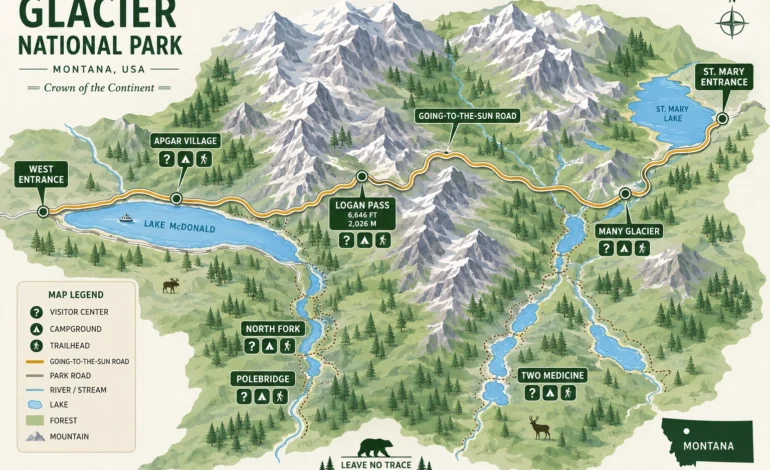
This is the part that trips people up most. Glacier isn’t one loop; it’s a scatter of valleys connected by a single high-elevation road, with several areas that only connect to the outside world, not to each other.
| Area | Side of Park | Connects To | Best Known For |
|---|---|---|---|
| West Glacier / Apgar | West | Going-to-the-Sun Road | Lake McDonald, park headquarters |
| Many Glacier | East (north) | Dead-end valley, no through road | Grinnell Glacier hike, wildlife |
| St. Mary | East | Going-to-the-Sun Road | St. Mary Lake, east entrance hub |
| Two Medicine | East (south) | Dead-end valley, no through road | Quiet trails, fewer crowds |
| North Fork / Polebridge | Northwest | Separate gravel road system | Remote camping, dark skies |
Notice that Many Glacier and Two Medicine don’t connect to each other or to the main road corridor directly. If you’re trying to visit both in one day, you’ll be backtracking through West Glacier or driving well outside the park to get between them.
The Entrances You’ll See Marked
A Glacier National Park map shows several entrance points, and picking the right one saves real driving time depending on where you’re headed.
| Entrance | Nearest Town | Best For |
|---|---|---|
| West Entrance | West Glacier | Going-to-the-Sun Road, Lake McDonald |
| St. Mary Entrance | St. Mary | East side of Going-to-the-Sun Road |
| Many Glacier Entrance | Babb | Grinnell Glacier, Swiftcurrent Lake |
| Two Medicine Entrance | East Glacier | Two Medicine Lake, quieter trails |
| Camas Entrance | West Glacier area | North Fork Road, avoids the busiest gate |
| North Fork / Polebridge | Polebridge | Bowman and Kintla Lakes, remote camping |
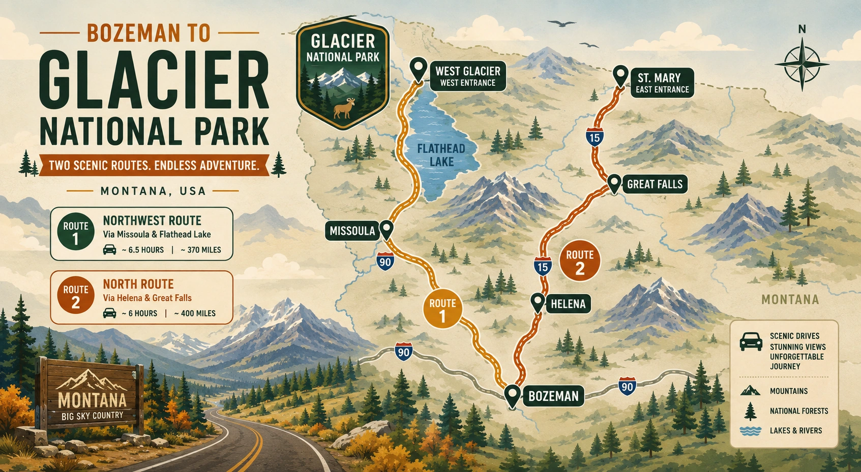
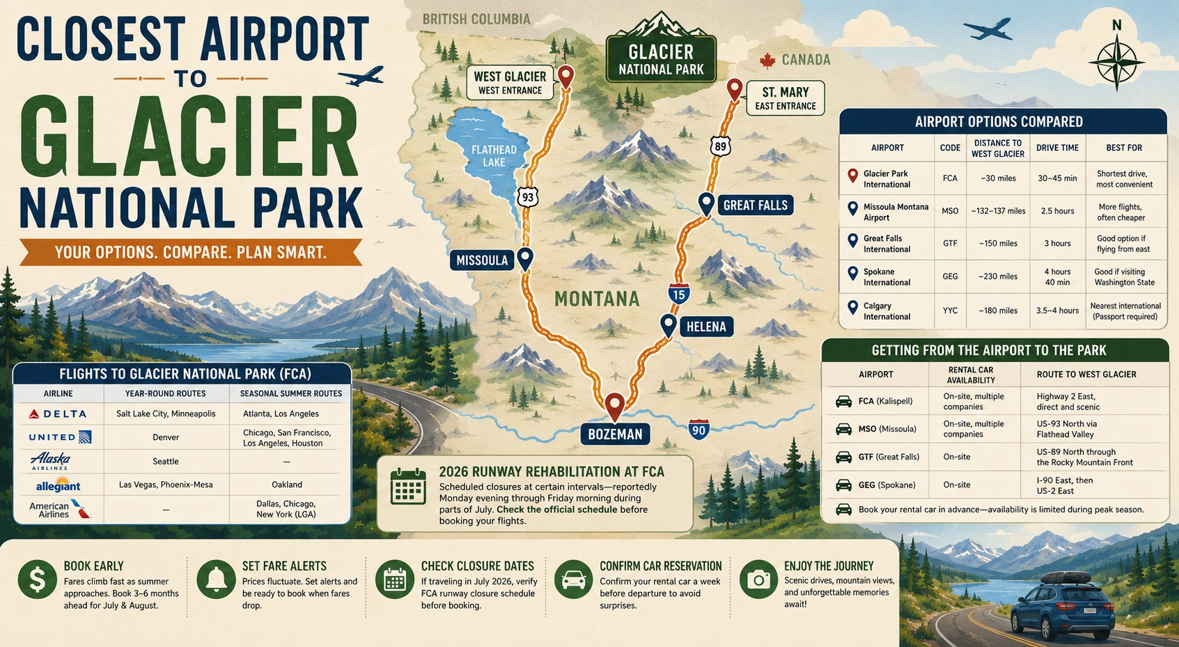
West Entrance and St. Mary Entrance are the two you’ll use if driving the full length of Going-to-the-Sun Road is your main goal, since the road runs directly between them. If you’re flying in, Glacier Park International Airport sits closer to the West Entrance, roughly a 30-minute drive, which makes the west side the more convenient base for most first-time visitors arriving by air.
Following Going-to-the-Sun Road on the Map
This 50-mile stretch is the spine of the whole park, and it’s usually the first line your eye follows on any Glacier national park map. It starts near Apgar on the west side, climbs alongside Lake McDonald, switches back sharply up to Logan Pass at the Continental Divide, then drops down past St. Mary Lake to the east entrance. Every major west-side trailhead, from Avalanche Lake to the Hidden Lake Overlook at Logan Pass, sits directly off this one road, which is part of why it gets so congested during peak summer months.
Visitor Centers Worth Marking
Knowing where the staffed visitor centers sit on the map matters more than it seems, especially since cell service inside the park is close to nonexistent.
| Visitor Center | Location | Typical Season |
|---|---|---|
| Apgar Visitor Center | West side, near Lake McDonald | Year-round (limited hours off-season) |
| Logan Pass Visitor Center | Top of Going-to-the-Sun Road | Mid-June through September |
| St. Mary Visitor Center | East entrance | Late May through early October |
If you lose cell signal, and you likely will, these three locations are where you can still get current trail and road updates directly from park staff.
Common Landmarks You’ll Spot Right Away
A few features show up on every version of the map, and knowing what they look like before you go makes reading it on the road much faster.
| Symbol/Feature | What It Marks |
|---|---|
| Solid black line | Going-to-the-Sun Road and other paved roads |
| Dashed line | Hiking trails |
| Blue shading | Lakes, including Lake McDonald and St. Mary Lake |
| Tent icon | Campgrounds, both reservable and first-come, first-served |
| Small building icon | Visitor centers, ranger stations, and lodges |
Campground icons are worth studying closely before your trip, since some sites require reservations booked months out through Recreation.gov, while others operate strictly first-come, first-served and fill by mid-morning in peak season.
Paper Map or Phone App
I still carry a paper map every single trip, and I’d recommend you do too, purely as backup. Phone signal drops the moment you’re a mile or two into most valleys here, and a dead battery or lost signal at the wrong moment turns a minor inconvenience into a real problem on an unfamiliar trail. That said, downloading an offline map app before you leave home gives you GPS positioning even without signal, which pairs well with a paper copy rather than replacing it entirely.
Frequently Asked Questions
Yes, the standard NPS map is free and handed out at every entrance station and visitor center. A downloadable PDF version is also available on the park’s official website if you want it before your trip.
No, and this catches a lot of first-time visitors off guard. Many Glacier and Two Medicine are both dead-end valleys that only connect back out to the highway system, not to Going-to-the-Sun Road or to each other.
Use the West Entrance if you’re starting from the Kalispell or Whitefish area, or the St. Mary Entrance if you’re coming from the east. Either lets you drive the full length of Going-to-the-Sun Road in a single day.